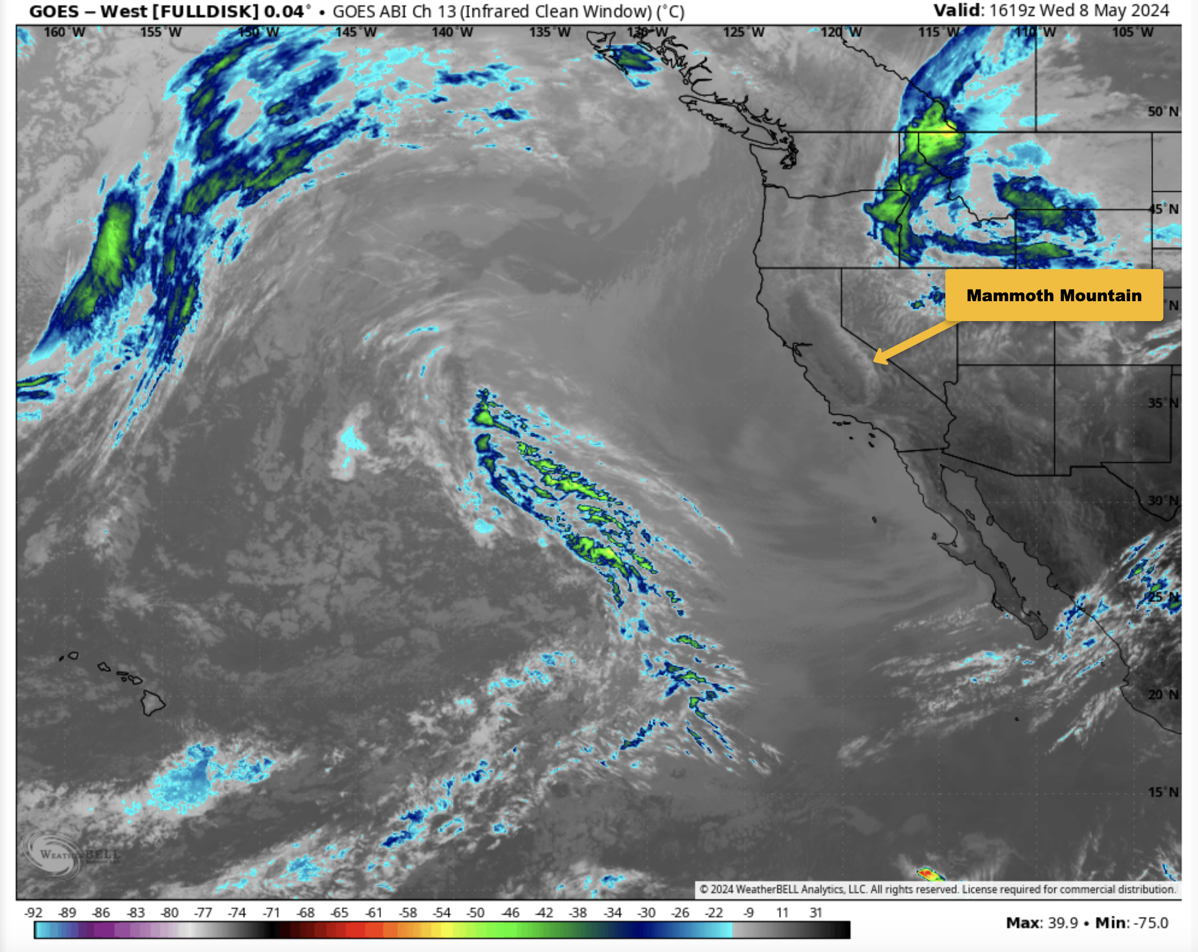

April 29th, 2024 @ 8 AM – Clear skies are forecast over Mammoth Mountain and the entire Eastern Sierra right through next Saturday.
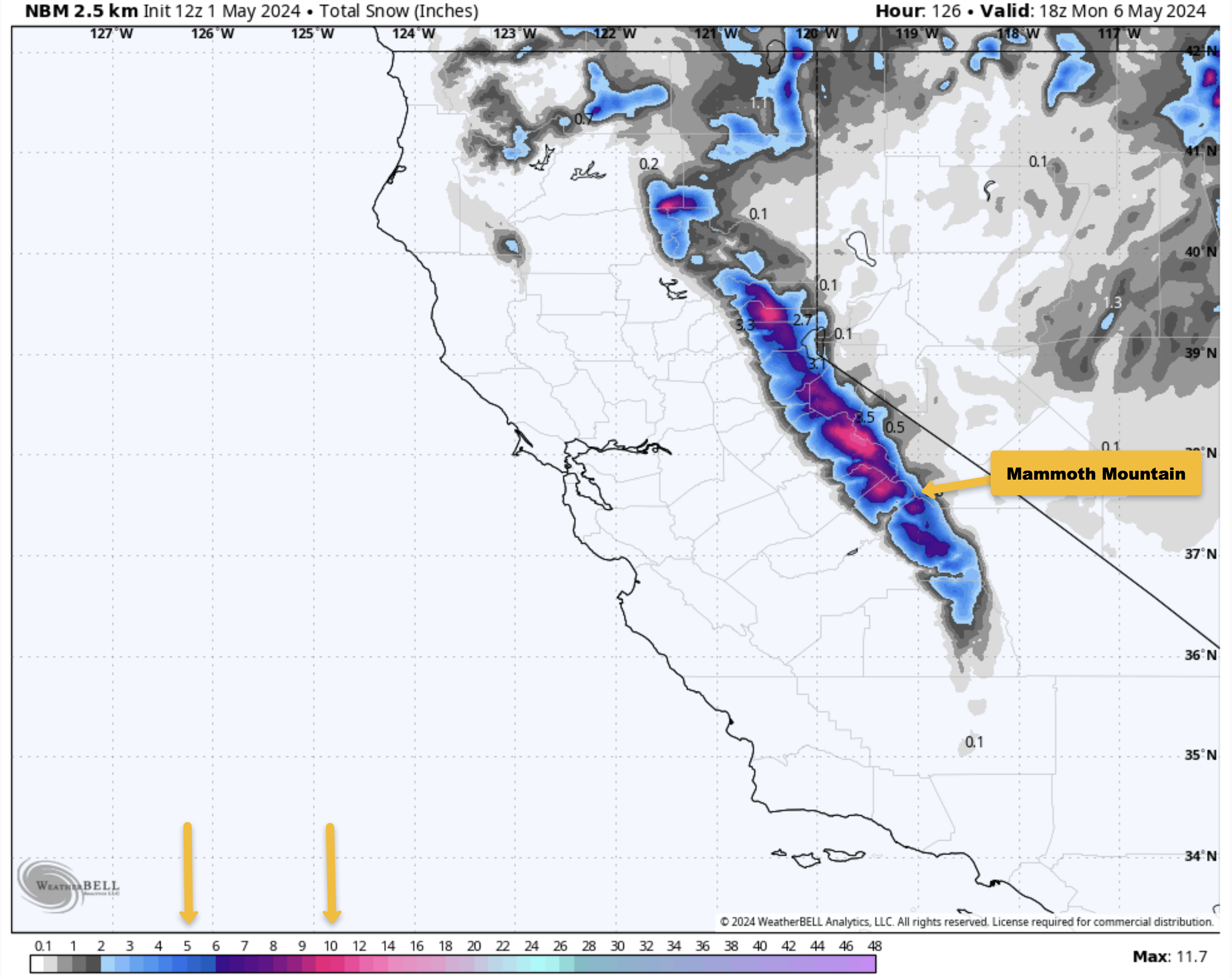
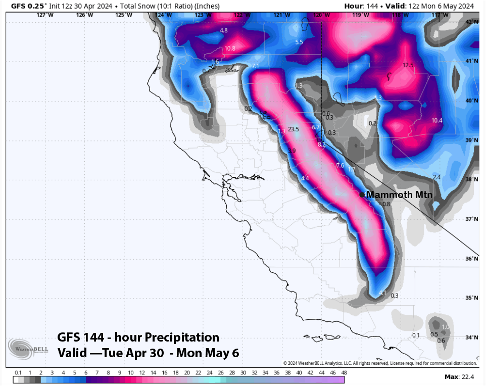
By next Sunday, models will have a weak system moving into the area. That low looks to bring a dusting to possibly several inches of snowfall.
With that low being seven days out, the confidence in how much, if any, snow Mammoth Mouintain gets is low.
This week, the ski area’s temperatures will be in the mid-50s by midmorning, with overnight lows down into the upper 20s to lower 30s.
The models show some cooling midweek (3-5 degrees) but a warm-up again on Friday and Saturday.
Winds over the next week look to be mostly light at 5-15 MPH out of the SW. Winds will pick up a bit on Tuesday and Wednesday, with gusts of 30 MPH.
Highs in Mammoth Lakes will be in the upper 50s to lower 60s this week, with overnight lows into the 30s. In Bishop, afternoon temperatures will be around 80 for the next couple of days, with upper 70s mid-week and low 80s for the weekend. Winds will be light over that time frame.
It looks like a great week to Ski, Snowboard, Fish, Hike, and Mountain Bike. Yahoo


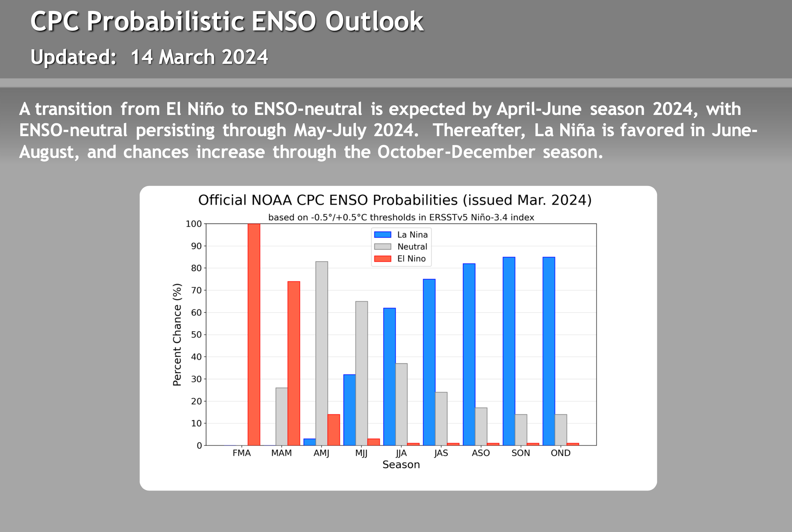
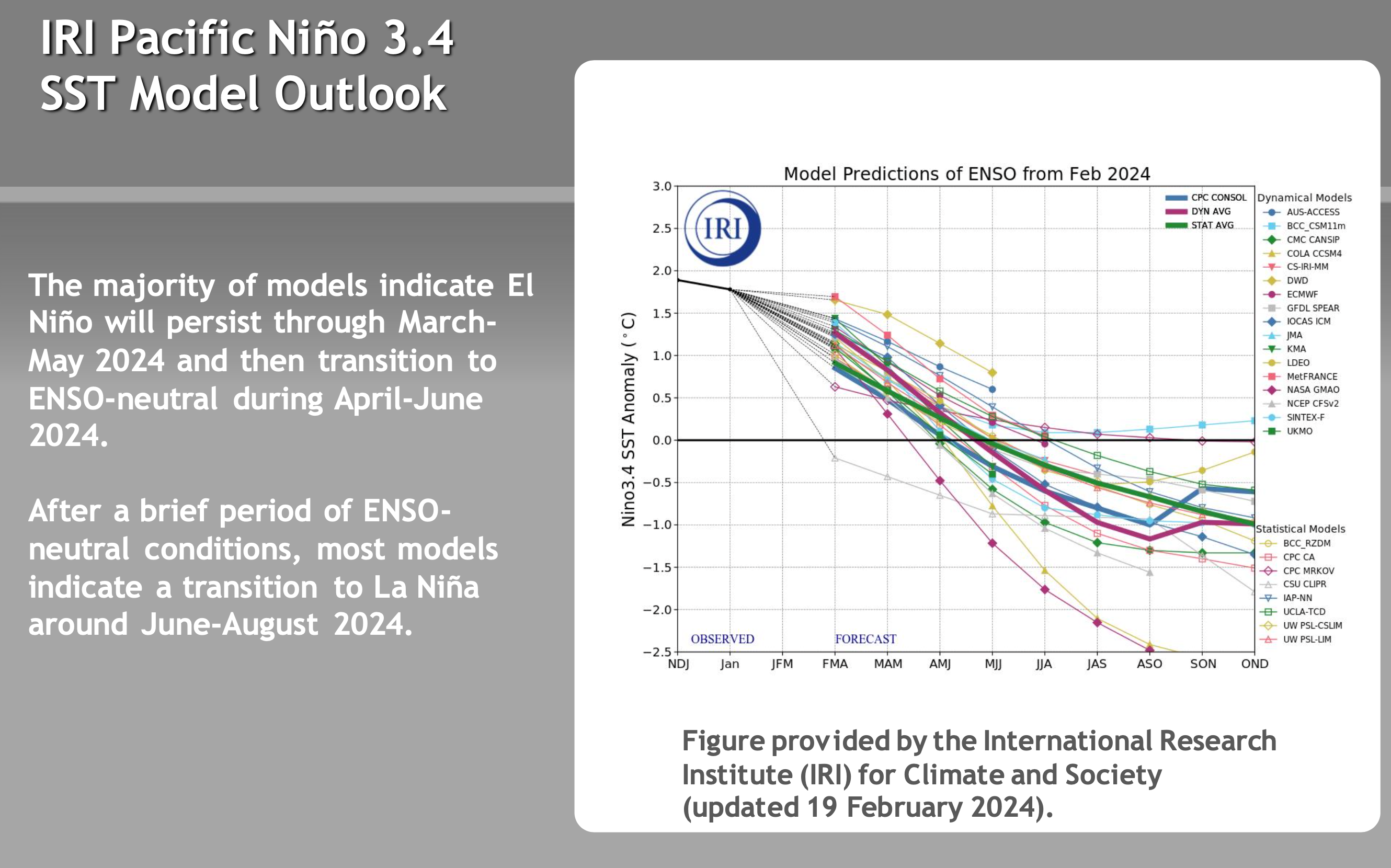
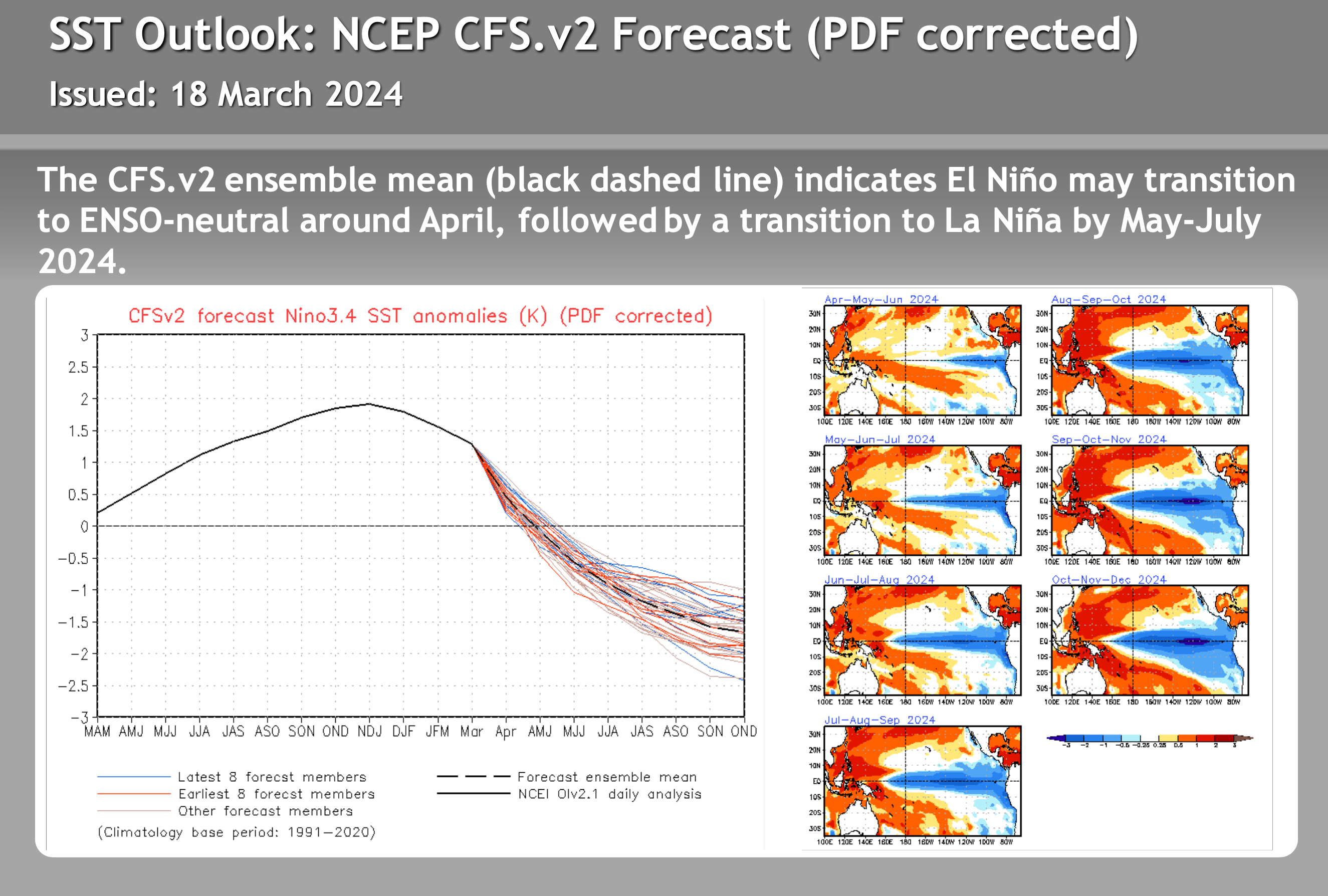
El Nino – La Nina – Neutral Watch


Author – Steve Taylor – The Mammoth Snowman – Over the last 30+ years, Snowman has spent countless hours studying and learning about Mammoth Mountain Weather and Snow Conditions first hand. He has been skiing around the hill with marked ski poles since March of 1991 so he can measure the fresh snowfall amounts out on the hill.
Snowman started blogging this information back in 1990 on the old Mammoth BBS system, then the RSN Forums and then on to MammothSnowman.com in 2004 with Video & Photo Blog reports. (No YouTube back then). Facebook got added to the fold back in 2008 and then the Facebook Group in 2016.
Reports, videos, and photos from the website have been featured on both local TV Stations here in Mammoth and Bishop, along with KTLA, AP, Fox, ABC, CBS, and NBC News.
Click Here to Learn More About the People Who Make MammothSnowman.com a Reality


